Hiking
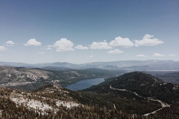
Truckee
1. Tompkins Memorial Trail
Distance: Various Loops
Difficult: Easy
The trailhead for this footpath is located near Big Springs Dr. The trail is visibly marked with map of trail system. The trails cover flat meadows and gentle hills and offer a diversity of nature-viewing opportuni-ties through Martis Valley.
2. Mt. Judah
Distance: 4.8 mile loop
Difficulty: Intermediate
Take Old Highway 40 to the trailhead for the Pacific Crest Trail. Follow signs along the trail for Mt. Judah. Enjoy this shaded hike to the top of Mt. Judah, with gorgeous wildflowers in early summer.
3. Castle Peak Trail
Distance: 6 miles round tip
Difficulty: Hard
From Interstate 80, take the Boreal exit and park on the right. This is one of the easier peaks to hike in the Tahoe area. Hike over to Andesite Peak or Basin Peak if you have extra time!
4. Sagehen Creek Trail
Distance: 4.5 mile loop
Difficulty: Easy
Just a few miles north on Highway 89, this popular trail is great for all levels. Follow Sagehen Creek to Stampede Reservoir. Enjoy wildflowers in early summer and end with a jump in the lake!
North Shore
1. Spur Trail
Distance: 3.2 miles round trip
Difficulty: Intermediate
Park on Highway 267 in the large parking lot about 0.5 miles south of Brockway Summit. Follow the Tahoe Rim Trail signs for about a mile. Turn left on Spur Trail View. In about 0.5 miles enjoy beautiful views of Lake Tahoe from ‘Picnic Rock’.
2. Martis Peak
Distance: 8 miles one-way
Difficulty: Intermediate
Take Highway 267 south. Just before the summit turn left onto a Forest Service road. Follow this road a few miles to a small parking area and Forest Service gate. It is only a short uphill walk from here to the lookout. For those who prefer human power, the Tahoe Rim Trail offers a steep five-mile path to the look-out. Enjoy spectacular views of Lake Tahoe and the High Sierra.
3. Mt. Rose
Distance: 10.7 miles round trip
Difficulty: Hard
From Incline Village take Highway 431 to the Mt. Rose summit. Park in the parking lot on the left. This out-and-back trail features a waterfall and gorgeous wildflowers in early summer. This challenging hike is worth the views of Lake Tahoe from the summit.
4. Tahoe Rim Trail
The Tahoe Rim trail is a 165 mile trail that loops around Lake Ta-hoe. Various trailheads allows for out-and-back hikes. Follow direc-tions for Spur Trail to hike the Brockway Summit portion of the trail.
5. Shirley Lake
Distance: 5 miles round trip
Difficulty: Intermediate
This trailhead is located off of Squaw Valley Rd at the base of Squaw Valley. Hike along gorgeous water-falls and canyon boulders. Hike back down for an out-and-back adventure or take the tram down from High Camp.
East Shore/West Shore/South Shore
1. Marlette Lake
Distance: 10 miles round trip
Difficulty: Intermediate
Park at the Spooner Lake Trailhead on the East Shore of Lake Tahoe. This moderate uphill hike ends at Marlette Lake. This Lake is a fish hatchery so no fishing is allowed. A great fall hike to see the changing leaves of the aspens lining the east side of the lake.
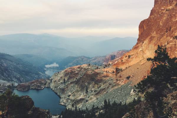
2. Eagle Falls/Eagle Lake
Distance: 2 miles round trip
Difficulty: Easy/Moderate
Leading into the heart of Desolation Wilderness, this steep trail offers majestic views. It is a short hike to Eagle Lake. A longer hike will lead to Velma Lakes and Fontanilis Lakes. Be sure to stop along the way to the Lake to view Eagle Falls.
3. Rubicon Trail
Distance: 5 miles one-way
Difficulty: Easy
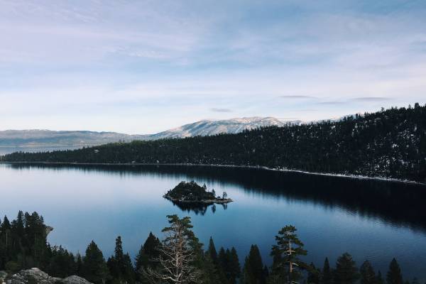
Dipping up and down the shoreline of Lake Tahoe, this trail offers some of the most scenic views of the lake. Hike out and back from the parking lot at D.L. Bill State Park, or shuttle a car to the Emerald Bay Parking Lot for a shorter, one-way hike.
4. Mt. Tallac
Distance: 10.2 mile round trip
Difficulty: Hard
Take Highway 89 south and turn right on Mt. Tallac Road. Park and be sure to fill out your wilderness permit. Mt. Tallac is the tallest peak in the Tahoe basin. The trail brings you along alpine lakes and sce-nic ridgelines. The 3,500 elevation gain is well worth the views of Lake Tahoe.