Our Top 7 Best Hikes in North Lake Tahoe
2025
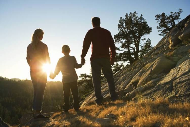
When most people think of North Lake Tahoe, they picture the sparkling blue lake or the stunning mountain views—and for good reason. Year-round, North Lake Tahoe bustles with a variety of outdoor activities, but one stands out as a local favorite: hiking. From short, easy trails perfect for kids to more challenging adventures for experienced trekkers, the region offers some of the best hikes in North Lake Tahoe. Whether you're a seasoned hiker or just getting started, there's a trail waiting for you. Join us as we explore our top 7 picks for the best hikes in North Lake Tahoe.
Explore Tompkins Memorial Trail – Scenic North Lake Tahoe Hiking for All Skill Levels
Distance: Various Loops
Difficult: Easy to Hard
Tompkins Memorial Trail is a network of over 17 miles of trails through Martis Valley. Ranging from easy hikes to more difficult ones, you'll be able to pick a trail based on the experience you're looking for. Regardless of the path you decide to take, you'll be stunned by the natural beauty of the Martis Creek Wildlife Area. Throughout the trails, you'll find memorial benches and picnic tables so you can rest and nature watch for the whole family.
These trails connect many neighborhoods, including those in Northstar Resort, to the Martis Valley and Porcupine Hill areas. You can easily access this trail network by parking at the Village of Northstar.
Family-Friendly Hiking: Sagehen Creek Trail in Truckee
Distance: 6 miles round trip
Difficulty: Easy
A popular family-friendly trail is Sagehen Creek in Truckee. This trail is 6 miles round trip, and while it seems like a long trip, it's a very easy hike. The path is flat, perfect for meandering. The trail follows the Sagehen Creek, obviously it's the trails namesake, but it ends at the Stampede Reservoir. When you reach the reservoir, feel free to jump in and refresh before hiking back.
Accessing the trailhead is also pretty easy. It's just a few miles north on Highway 98 North, where there is a large dirt pullout for parking.
Dog-Friendly Hiking in North Lake Tahoe: Shirley Canyon Trail
Distance: 4 miles round trip
Difficulty: Moderate
Shirley Canyon is a beautiful hiking trail in Olympic Valley. It leads up the mountain through waterfalls and canyon boulders. The best time to visit this trail is from June through October, and the best thing about it is that it's dog-friendly! Your dog can enjoy the hike as well; however, he must be on a leash the entire time.
This trail has become increasingly popular over the years. When visiting, please park in the designated Squaw Valley parking lot, just 150 yards from the trail head. But don't worry—it's a large parking lot, so you'll surely find a spot.
Hike Mt. Judah Loop for Stunning Tahoe Sierra Views
Distance: 4.6-mile loop
Difficulty: Moderate
For some of the best views of the Tahoe Sierra, you'll want to hike the Mt. Judah loop. This rugged terrain around Donner Pass provides several scenic trails over the lake and the Sierra Nevada Mountains. The trail is open year-round for hikers, horseback riders, and snowshoers.
Take Old Highway 40 to the trailhead for the Pacific Crest Trail. Follow the signs along the trail for Mt. Judah.
Castle Peak Trail – A Year-Round Challenge with Stunning Summit Views
Distance: 5.4 miles round trip
Difficulty: Hard
One of the more challenging North Lake Tahoe hikes, this trail is open year-round and is popular for snowshoeing, running, and, of course, hiking. The views at the top of the trail are absolutely stunning; however, you'll need to scramble up a very steep section of rock to reach the true summit. If you're uncomfortable with this part of the hike, we recommend skipping it and going around. But don't worry, if you do go around, you'll still be able to complete the entire loop.
From Interstate 80, take the Boreal exit. From the Boreal parking lot, go under the freeway and follow the road up to the trailhead. Then you can park anywhere on the right.
Martis Peak Trail – Scenic Summit Hike Near Kings Beach
Distance: 9.6 miles round trip
Difficulty: Hard
Near Kings Beach is Martis Peak Trail. One of the more challenging trails in the area, however, it has some of the best views of the North Shore of Lake Tahoe. Starting on the Tahoe Rim Trail, this trail leads you up the mountain to a 100-year-old fire lookout. If you don't want to make the entire trip up but still want some fantastic views, don't worry! You'll pass several other viewing areas, including Picnic Rock, Lake Tahoe.
This trail is open year-round, but the best time to visit is between March and December. It also makes a great snowshoeing trail in the winter. You can access this hike on Highway 267 just before Brockway Summit.
Tahoe Rim Trail - Lake Tahoe's Most Popular and Recognized Tails
Distance: 165 miles Loop
Difficulty: Hard
One of Lake Tahoe's most well-known trails is the Tahoe Rim Trail. This Trail loops entirely around Lake Tahoe. While you could tackle the entire trail for a backpacking trip, many of our guests like to explore a small portion of it.
The best local trailhead to embark on this hiking trail is Brockway West. The Brockway Summit to Mt. Rose Summit is 20.2 miles of the overall trail. This trail is home to the highest point on the Tahoe Rim Trail, Relay Peak. But don't worry about completing this entire hike; you can head back to the trailhead at any point you'd like.
To reach the Brockway Summit Trailhead, take Highway 267 to the summit. There is a parking lot on the side of the road, and the trailhead is located across the street.
Your Hiking Adventure Awaits in North Lake Tahoe!

Featured Property: Sutter's Trail, Old Greenwood 11221
North Lake Tahoe is home to various hikes for every level of hiker. From kid-friendly hikes to hiking adventures, you'll find the perfect trail for your next Lake Tahoe vacation.
However, you're missing one piece: a place to stay! At Tahoe Exclusive Vacation Rentals, we have various homes and condos available for you to choose from.
Categories: